
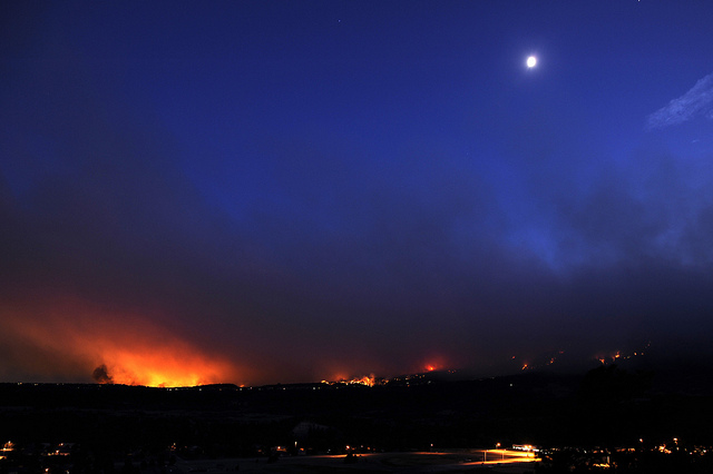
There is a lack of drenching rainfall over Colorado and neighboring areas, adding to wildfire woes and while there have been some thunderstorms, not enough rain has fallen over a broad area to significantly impact tinder-dry conditions.
Slideshow courtesy Dan Sadowskis (Harrison Sadowski from Flickr.com)
The storms will to continue to bring little or no rainfall in the weeks ahead. The meterological reason for this, is that the air over the region is much too dry to allow rain falling at cloud level in the storm to reach the ground.
What happens is that the evaporating rain cools the air, which then races to the ground in the form of strong gusts. In turn, the gusty winds generated nearby from the storms fan the flames of existing fires, while lightning strikes from the storms threaten to start new fires.
According to Paul Pastelok, head of AccuWeather.com‘s Long Range Experts, “It appears the zone of high pressure over the region now will last through much of July and could continue through much of August.”
The monsoon, as locals call it, will bring up humid air up from Mexico, and produce thunderstorm activity over the Southwest in general in the coming weeks, but it will tend to “go around” rather than through most of Colorado.
While temperatures will occasionally throttle back in coming weeks, the overall massive heat pump will remain in place over Colorado through the middle of summer.
Even in areas that manage to get a couple of rainfalls of 0.10 of an inch from one of the spotty thunderstorms the next week or so, long sun-filled days and evaporation rates of 0.25 to 0.50 of an inch per day will rapidly trump rainfall.
By Alex Sosnowski, Expert Senior Meteorologist for AccuWeather.com
Related articles


Be First to Comment